Tour Wandern Tre Ville - 2017-09-05 Réf. Graffer-Groste-ref.Allimonta - Photo

2017-09-05 Réf. Graffer-Groste-ref.Allimonta

 meunier.ph.
meunier.ph.

Benutzer

© OpenStreetMap contributors
Länge
Länge
10,5 km
Maximale Höhe
Maximale Höhe
3034 m
Positive Höhendifferenz
1183 m
Km-Effort
Km-Effort  
25 km
Min. Höhe
Min. Höhe
2255 m
Negative Höhendifferenz
855 m
Boucle
Boucle
Nein
Erstellungsdatum :
2018-04-16 23:14:48.955
Letzte Änderung :
2018-04-16 23:14:48.955

(0 Nachricht)

Wandern
Wandern
5h21
Schwierigkeit : Sehr schwierig

Scannen Sie diesen QR-Code, um die Tour in der SityTrail-Anwendung zu öffnen

Kostenlosegpshiking-Anwendung

Logo SityTrail SityTrail

IGN / Geografische Institute

SityTrail aus dem App Store herunterladen SityTrail von Google Play herunterladen

Logo SityTrail SityTrail World

Die Welt öffnet sich für Sie

SityTrail aus dem App Store herunterladen SityTrail von Google Play herunterladen SityTrail auf Huawei AppGallery herunterladen

Über SityTrail

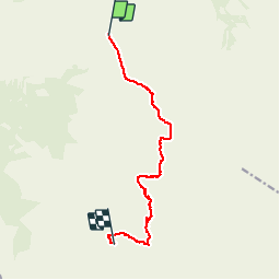
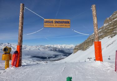
Tour Wandern von 10,5 km verfügbar auf Trentino-Südtirol, Provincia di Trento, Tre Ville. Diese Tour wird von meunier.ph. vorgeschlagen.

Beschreibung

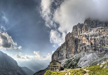
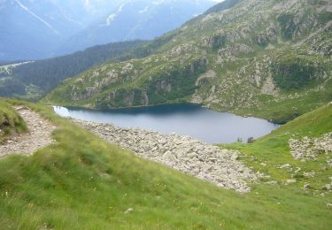
Parcours de Via Ferrata demandant un équipement spécifique et une certaine maîtrise de la haute montagne.
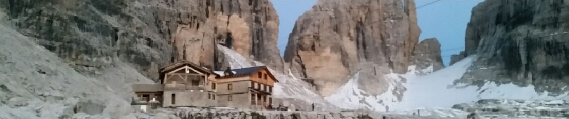
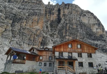
 Départ du refuge Graffer: Via Ferrata Benini, Bocchetta Alto et Olivia Detassis et arrivée au ref. Alimonta.
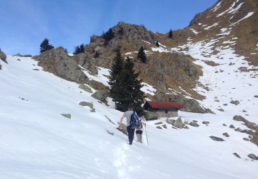
La trace GPS n'est pas précise surtout entre les parois très abruptes du parcours qui ne reçoivent pas le signal satellite.
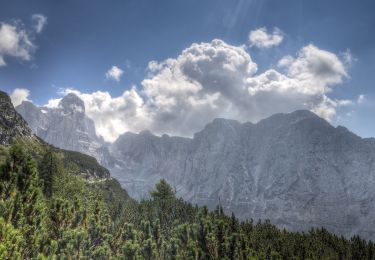
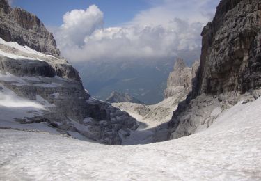
Très beau parcours.
Les parties les plus exposées, comme dans la plupart des Vias des Dolomites, se situent dans certains passages non câblés.
Cela demande un pied sûr et une attention constante.

Höhenprofil

Foto-Galerie

Ort

Land:
Italy
Region :
Trentino-Südtirol
Abteilung/Provinz :
Provincia di Trento
Kommune :
Tre Ville
Standort:
Unknown
Gehen Sie:(Dec)
Gehen Sie:(UTM)
645717 ; 5120177 (32T) N.

Touren in der Umgebung

Tour Zu Fuß Tre Ville - Sentiero
Zu Fuß
PRO

Zu Fuß

Einfach
Tre Ville, Trentino-Südtirol, Provincia di Trento, Italy
3,6 km | 7,6 km-effort
1h 44min
Nein
Tour Zu Fuß Ville d'Anaunia - Via ferrata delle Bocchette
Zu Fuß
PRO

Zu Fuß

Einfach
Ville d'Anaunia, Trentino-Südtirol, Provincia di Trento, Italy
4,9 km | 11,1 km-effort
2h 30min
Nein
Tour Zu Fuß Ville d'Anaunia - Via ferrata delle Palete - Photo
Zu Fuß
PRO

Zu Fuß

Medium
Ville d'Anaunia, Trentino-Südtirol, Provincia di Trento, Italy
12,4 km | 25 km-effort
5h 38min
Nein
Tour Zu Fuß Tre Ville - Via ferrata alpinistica
Zu Fuß
PRO

Zu Fuß

Einfach
Tre Ville, Trentino-Südtirol, Provincia di Trento, Italy
3,9 km | 11,5 km-effort
2h 36min
Nein
Tour Zu Fuß Molveno - IT-O314 - Photo
Zu Fuß
PRO

Zu Fuß

Medium
Molveno, Trentino-Südtirol, Provincia di Trento, Italy
12,8 km | 23 km-effort
5h 10min
Nein
Tour Zu Fuß Pinzolo - Sentiero di Serodoli e Nambrone - Photo
Zu Fuß
PRO

Zu Fuß

Medium
Pinzolo, Trentino-Südtirol, Provincia di Trento, Italy
11,1 km | 24 km-effort
5h 30min
Nein
Tour Zu Fuß Pinzolo - IT-O277 - Photo
Zu Fuß
PRO

Zu Fuß

Einfach
Pinzolo, Trentino-Südtirol, Provincia di Trento, Italy
6,9 km | 12,7 km-effort
2h 53min
Nein
Tour Zu Fuß Tre Ville - Sentiero di Val Brenta - Photo
Zu Fuß
PRO

Zu Fuß

Medium
Tre Ville, Trentino-Südtirol, Provincia di Trento, Italy
9,4 km | 24 km-effort
5h 25min
Nein
Tour Zu Fuß Tre Ville - Sentero della Corna Rosa - Photo
Zu Fuß
PRO

Zu Fuß

Einfach
Tre Ville, Trentino-Südtirol, Provincia di Trento, Italy
4,9 km | 12,3 km-effort
2h 47min
Nein


Schließen
Meine Abonnements